Physical Geography Laboratory
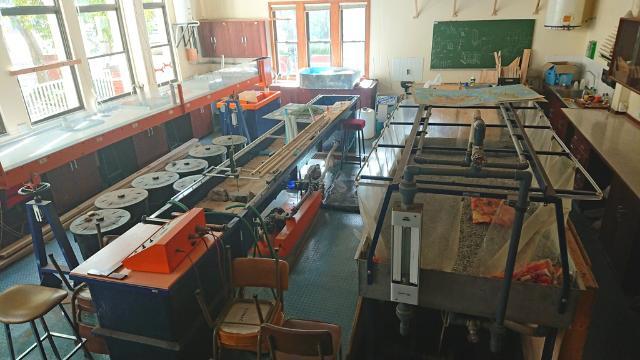
The Physical Geography Laboratory has several pieces of equipment designed to demonstrate, and, research into, the way water contributes to the formation of land mass features. Rainfall, runoff and stream flow simulations in the micro-environment of the laboratory give important indicators to the mechanisms driving the formation of river bed, floodplain and other features we are familiar with in the macro-environment that is our landscape. This area has been remodelled to double as a postgraduate teaching and undergraduate practical unit while still being useful for research purposes.
Soil Analysis
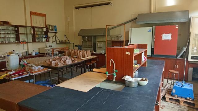
With the possible exception of the Computing Laboratory the Soils Laboratory is probably the most used facility in the Department. It is designed to allow postgraduate students, in the course of their research projects, to analyse soil samples for characteristics such as - low level chemical composition, particle size, soil classification type, and other general physical analyses such as plasticity and liquid limit analysis.
Water Analysis
The Water Quality Laboratory is equipped to provide a sophisticated postgraduate training facility for the chemical analysis of surface and ground waters - the suitability for irrigation, and, the chemical contribution water sources may make into the soils environment in research studies, for instance. The laboratory is used by honours, masters and doctoral level students and for staff research.
GIS, Mapwork and Computing
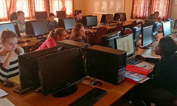
The Department manages a postgraduate GIS laboratory which is used for teaching and research programmes and is available to other departments by arrangement. The major use for the facility is GIS (Geographical Information Systems) and Remote Sensing training and research. The work ranges from basic digitising of paper maps to sophisticated satellite image analysis and distribution analyses of virtually any data one can think of from distribution of crime and sales of eggs at different stores to locating release sites for captive bred wildlife.
Environmental Tracing Laboratory
The Environmental Tracing Laboratory was established in the Geography Department in 2010 with funding provided by the NRF and Rhodes University. This laboratory provides geomorphologists with a suite of equipment that can be used to study the dynamics of sediment movement within rivers and their catchments.
Four pieces of equipment are available for use in characterising the magnetic susceptibility and remanence properties of soils and sediments. This characterisation allows interpretation of both magnetic grain size (domains) and magnetic mineralogy. Analysis of these properties for sediment samples collected in the field provides a valuable technique for tracing the origin and movement and deposition of sediment within the landscape.
The Bartington MS2B susceptibility bridge is a laboratory sensor for dual frequency measurements of magnetic susceptibility.
The Molspin Pulse Magnetiser is used to induce an IRM into a rock or soil sample
The Shielded Demagnetizer enables rock or soil samples to be demagnetized
The Minispin Portable Magnetometer measures magnetic remnance of processed samples.
Our Department also has a gamma detector used to identify radionuclides in sediments using gamma spectrometry providing a means of dating sediments and developing a chronology of recent deposits (past ~100 years). Two radionuclides widely used for dating are 137Cs and unsupported 210Pb. An important use of 137Cs is to distinguish sediment derived from topsoils from those derived from subsoils. Other radionuclides used for sediment tracing include 7Be, 40K, 228Ac and 235U.
John Daniel Map Library
The Department has a comprehensive library of printed and digital maps of South Africa at various scales produced by the Department of Surveys and Mapping in Mowbray, Cape Town. A number of map sets from other countries are also available. An interesting collection of historical maps is also housed in the Department's map archive room. The holdings of electronic map coverages is growing larger on a monthly basis and are available here digital maps.
Library hours Monday to Friday
11h30-12h30 and 13h30-15h30 only
Last Modified: Wed, 15 Jan 2020 11:01:01 SAST